Ganges River: Difference between revisions
imported>Pradyumna Singh (Ganga Action Plan) |
mNo edit summary |
||
| (39 intermediate revisions by 4 users not shown) | |||
| Line 5: | Line 5: | ||
| datastyle = background:#eef; color:#009; | | datastyle = background:#eef; color:#009; | ||
| title = | | title = River Ganges | ||
| titlestyle = background:#037; color:#cff; | | titlestyle = background:#037; color:#cff; | ||
| subtitle = A major river of India | | subtitle = A major river of India | ||
| subtitlestyle = color:#007; | | subtitlestyle = color:#007; | ||
| Line 14: | Line 14: | ||
| 1_data = --- | | 1_data = --- | ||
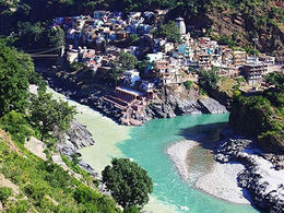
| 2_data = {{image|Devprayag-confluence.jpg|center|260px| | | 2_data = {{image|Devprayag-confluence.jpg|center|260px|Confluence in Devprayag}} | ||
| 3_label = Country | | 3_label = Country | ||
| 3_data = | | 3_data = India | ||
| 4_label = States | | 4_label = States | ||
| 4_data = | | 4_data = Uttarakhand, Uttar Pradesh, Bihar, Jharkhand, West Bengal, | ||
| 5_label = Cities | | 5_label = Cities | ||
| 5_data = | | 5_data = Haridwar, Kanpur, Allahabad, [[Varanasi]], Kolkata | ||
| 8_label = Source | | 8_label = Source | ||
| 8_data = Gangotri Glacier, | | 8_data = Gangotri Glacier, Uttarakhand, India | ||
| 9_label = Mouth | | 9_label = Mouth | ||
| 9_data = | | 9_data = Bay of Bengal | ||
| 20_label = Length | | 20_label = Length | ||
| Line 44: | Line 44: | ||
| 24_label = Discharge | | 24_label = Discharge | ||
| | | 24_data = 14,270 cu.m/sec | ||
| 30_label = | | 30_label = Subpages | ||
| 30_data = --- | | 30_data = --- | ||
| 31_data = [[Ganges River/Related_Articles|Related_Articles]], [[Ganges River/Bibliography|Bibliography]] | |||
}} | }} | ||
''' | The '''Ganges''' (India: '''Ganga'''; Bangladesh: '''Padma''') is a major river system in the Indian subcontinent which flows west to east through North India's Gangetic plains, traversing 2,525 km in the course to discharge into the [[Bay of Bengal]] through its vast delta in the Sunderbans and Bangladesh. Several important tributaries discharge into the Ganges, which is the world's third largest river by discharge volume after the [[River Amazon|Amazon]] and [[River Congo|Congo]] rivers. The headstreams of the River Ganges in India's upper course are famous tourist attractions important to local economies, for spiritual tourism and [[Ganges River/Rishikesh_rafting|rafting in Rishikesh]]. | ||
'''Ganga''' | |||
The | The Ganges river basin is India's largest, irrigating the northern states of Uttarakhand, Uttar Pradesh, Haryana, Rajasthan, Himachal Pradesh, [[Delhi]], Madhya Pradesh, Chhattisgarh, Bihar, Jharkhand, and West Bengal. Important Indian cities on its banks include Kanpur, Patna, Kannauj, Kashi, Allahabad, Varanasi, and Kolkata. These cities generate large amounts of domestic and industrial pollution which has caused the 'holy' Ganges to die. The environmental degradation generated considerable protest and, in 1985, the Indian government implemented a [[Ganga Action Plan]] for river rejuvenation. | ||
The | The Ganges has been sacred to Hindus since ancient times and worshipped as the Goddess Ganga. Hindus make pilgrimages to it, especially to its sources and the cities of Haridwar, Varanasi and Allahabad (the Triveni confluence of the River Yamuna). On its banks are ''ghats'' (cremation pyres) and ritual steps for immersing ashes in the water of dead Hindus and performed ritual ablutions. | ||
{{TOC}} | {{TOC}} | ||
==Geography== | ==Geography== | ||
The Ganges is traditionally divided into two parts: the upper course (about 800 km from the source to the city of Kanpur), lower course (from Kanpur to the Farakka Barrage). | |||
===Upper Course (Himalayas and foothills)=== | |||
{{gallery | |||
|width = 180 | |||
|lines = 2 | |||
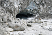
|Gaumukh 2009.jpg|Source of the Ganga, Gaumukh | |||
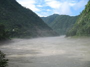
|1024px-Ganga at Kaudiayala.jpg|Morning mist over the Ganges at Kaudiayala, [[Uttarakhand]] | |||
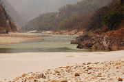
|A beach on the banks of Ganges, Rishikesh.jpg|A beach on the banks of Ganges, Rishikesh | |||
}} | |||
===Course of the Ganges=== | |||
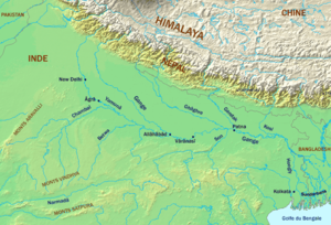
[[Image:River_Ganga_and_tributaries.png|thumb|right|300px|Course of [[Ganges River]] and tributaries]] | |||
====Tributaries==== | |||
Other than the Yamuna, the major water-rich tributaries of the Ganges flow to the left. Originating mostly in the Himalayas, they mitigate the low dissolved oxygen and pollutant concentration of the main stream. However, some of these tributaries also cause the largest flood hazard zone of the Ganges and regular overflowing of its high water banks causing destruction. The natural drainage network is now greatly altered by dense networks of artificial irrigation channels. Consequently, the Ganges and Yamuna have much of their flow diverted into irrigation canals and water treatment plants. | |||
=== | ====Cities on the Ganges==== | ||
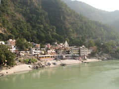
[[ | [[File:Eastern bank of Lakshman Jhula, Rishikesh.jpg|right|thumb|240px|Rishikesh]] | ||
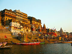
[[File:1024px-Ahilya Ghat by the Ganges, Varanasi.jpg|right|thumb|240px|[[Varanasi]]]] | |||
[[File:Kolkata BBD Bagh1.jpg|right|thumb|240px|Kolkata]] | |||
[[File:Bibir Pukur Barisal.jpg|right|thumb|240px|Barisal, Bangladesh]] | |||
The valley of the Ganges is one of the most densely populated places on the planet. Below are the largest of the cities located directly on the river. The list is sorted along the course, with the exception of the delta (in the state of West Bengal and Bangladesh). Most of West Bengal and almost a third of the territory of Bangladesh enter directly into the Ganga basin. Specified in the list of the city are located mainly on the distributaries Hooghly and Padma (main channel) as well as numerous small ducts. | |||
*[[India]] : | |||
:State of Uttarakhand : | |||
::Rishikesh (59,600) well known for [[Ganges River/Rishikesh_rafting|rafting in Rishikesh]] | |||
::Haridwar (175,100) | |||
:State of Uttar Pradesh : | |||
::Farrukhabad (275,750) | |||
::Kannauj (71530) | |||
::Kanpur (2,767,031) | |||
::Allahabad (1,117,094) | |||
::Mirzapur (233,691) | |||
::Varanasi (1,201,815) | |||
:State of Bihar : | |||
::Ara (203,395) | |||
::Chhapra (178 835) | |||
::Danapur (158488) | |||
::Patna (1,683,200) | |||
::Munger (187,311) | |||
::Bhagalpur (398,138) | |||
:State of Jharkhand : | |||
::nil | |||
:State of West Bengal : | |||
::Baharampur (160,168) | |||
::Krishnanagar (139,070) | |||
::Barasat (237,783) | |||
::Barrackpore (144,331) | |||
::Kolkata (4,486,679) | |||
::Howrah (1,072,161) | |||
::Alipore | |||
::Haldia (170,256) | |||
*[[Bangladesh]] : | |||
::Rajshahi (472,775) | |||
::Khulna (855,650) | |||
::Barisal (210,374) | |||
::Jessore (243,987) | |||
::Pabna (138,000) | |||
::Chandpur (94,821) | |||
====Sequence of tributary confluence==== | ====Sequence of tributary confluence==== | ||
Alaknanda joins Dhauliganga (at Vishnuprayag), Mandakini (at Nandprayag), Pindar (at Karnaprayag), Mandakini (at Rudraprayag) and ultimately Bhagirathi (at Devaprayag) from where onwards, it is known as [[ | Alaknanda joins Dhauliganga (at Vishnuprayag), Mandakini (at Nandprayag), Pindar (at Karnaprayag), Mandakini (at Rudraprayag) and ultimately Bhagirathi (at Devaprayag) from where onwards, it is known as [[Ganges River]]. The Bhagirathi is considered the prime source stream, fed by melting glacial snow and ice from peaks such as Kamet and Nanda Devi. | ||
{| class="prettytable sortable" | {| class="prettytable sortable" | ||
! Name<br /><br /><br /> || Mouth<br />of<br /><br /> || Discharge<br />(MQ)<br />[m³/s]<br /> || Length<br />[km]<br /><br /> || Catchment-<br />area<br />[km²] || Swell<br />[m.]<br /><br /> || Estuary-<br />height<br />[m.] || Confluence-<br />place<br /><br /> | ! Name<br /><br /><br /> || Mouth<br />of<br /><br /> || Discharge<br />(MQ)<br />[m³/s]<br /> || Length<br />[km]<br /><br /> || Catchment-<br />area<br />[km²] || Swell<br />[m.]<br /><br /> || Estuary-<br />height<br />[m.] || Confluence-<br />place<br /><br /> | ||
|- | |- | ||
|colspan="8"| | |colspan="8"| Headstreams<ref name="data1">Singh, Hasnain: [http://www.tandfonline.com/doi/pdf/10.1080/02626669809492181 Major ion chemistry and weathering control in a high altitude basin: Alaknanda River, Garhwal Himalaya, India] (PDF; 1,3 MB), 1998</ref><ref>Arun Kumar: [http://www.moef.nic.in/downloads/public-information/CH-7.pdf Assessment of Cumulative Impact of Hydropower Projects in Alaknanda and Bhagirathi Basins] (PDF; 5,6 MB), Chapter 7 Hydrology 30. Mar 2011</ref> | ||
|- | |- | ||
| | | Alaknanda | ||
| align="center" | left | | align="center" | left | ||
| align="right" | 440 | | align="right" | 440 | ||
| align="right" | 240 | | align="right" | 240 | ||
| align="right" | 12587 | | align="right" | 12587+ | ||
| align="right" | 4350 | | align="right" | 4350 | ||
| align="right" | 460 | | align="right" | 460 | ||
| align="center" | | | align="center" | Devprayag | ||
|- | |- | ||
| | | Bhagirathi | ||
| align="center" | right | | align="center" | right | ||
| align="right" | 260 | | align="right" | 260 | ||
| Line 91: | Line 145: | ||
| align="right" | 4120 | | align="right" | 4120 | ||
| align="right" | 460 | | align="right" | 460 | ||
| align="center" | | | align="center" | Devprayag | ||
|- | |- | ||
|colspan="8"| | |colspan="8"| Tributaries<ref name="data2">Sharad K. Jain, Pushpendra K. Agarwal, Vijay P. Singh: Hydrology and water resources of India. New York 2007</ref> | ||
|- | |- | ||
| | | Ramganga | ||
| align="center" | left | | align="center" | left | ||
| align="right" | 490 | | align="right" | 490 | ||
| Line 104: | Line 158: | ||
| align="center" | Ibrahimpur | | align="center" | Ibrahimpur | ||
|- | |- | ||
| | | Yamuna | ||
| align="center" | right | | align="center" | right | ||
| align="right" | 2940 | | align="right" | 2940 | ||
| Line 113: | Line 167: | ||
| align="center" | Sahon | | align="center" | Sahon | ||
|- | |- | ||
| | | Ghaghara | ||
| align="center" | left | | align="center" | left | ||
| align="right" | 2980 | | align="right" | 2980 | ||
| Line 120: | Line 174: | ||
| align="right" | 4800 | | align="right" | 4800 | ||
| align="right" | 48 | | align="right" | 48 | ||
| align="center" | | | align="center" | Chapra | ||
|- | |- | ||
| | | Son | ||
| align="center" | right | | align="center" | right | ||
| align="right" | 900 | | align="right" | 900 | ||
| Line 131: | Line 185: | ||
| align="center" | Dinapur | | align="center" | Dinapur | ||
|- | |- | ||
| | | Gandak | ||
| align="center" | left | | align="center" | left | ||
| align="right" | 1640 | | align="right" | 1640 | ||
| Line 140: | Line 194: | ||
| align="center" | Sonepur | | align="center" | Sonepur | ||
|- | |- | ||
| | | Kosi | ||
| align="center" | left | | align="center" | left | ||
| align="right" | 2160 | | align="right" | 2160 | ||
| Line 151: | Line 205: | ||
|} | |} | ||
=== | ===Ganges in Indian religion=== | ||
==== | ====Ganges in Hinduism==== | ||
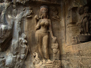
[[Image:Goddess_Ganga.JPG|thumb|right|300px|[[Goddess Ganga]], | {{Main|Ganga in Hindu tradition}} | ||
[http://www.wikimedia.xyz/index.php?n=Main.Ganga | [[Image:Goddess_Ganga.JPG|thumb|right|300px|[[Goddess Ganga]], Ellora Caves, Maharastra, [[Archaeological Survey of India]] monument number N-MH-A51]] | ||
[http://www.wikimedia.xyz/index.php?n=Main.Ganga The River Ganges] is generally regarded, since ancient times, amongst the world's most important and holiest rivers. It is held sacred by Indians, especially [[Hindu]]s, and is also worshipped in its anthropomorphic form as the [[Goddess Ganga]], emerging, from Bhagirathi her source, at Gangotri Glacier (in the Central Himalayan state of Uttarakhand) at Gaumukh (elevation 3,892 m). Ganga is embodied at Devprayag when the rampant Alaknanda joins swirling Bhagirathi. Numerous other streams join Himalayan Ganga, among these Mandakini, Dhauliganga, Bhilangana and Pindar are significant. | |||
===== | =====Ganges in the Doab===== | ||
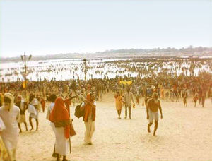
[[Image:Triveni Sangham.jpg|thumb|right|300px|Triveni Sangham - Kumbha Mela - Allahabad January 2001, India]] | [[Image:Triveni Sangham.jpg|thumb|right|300px|Triveni Sangham - Kumbha Mela - Allahabad January 2001, India]] | ||
According to legend, Allahabad Triveni (triple confluence) is one of the four places where the celestial bird Garuda spilled | According to legend, Allahabad Triveni (triple confluence) is one of the four places where the celestial bird Garuda spilled the immortality elixir Amrita from its holy pitcher, and why Hindus hold major Hindu festival - Kumbh Mela, or "Festival of pitchers." | ||
Allahabad (Prayag also - "the confluence" or Aggra - "place of sacrifice"), located at the confluence of the Ganges with the Jumna (Yamuna), is considered the place where Brahma was brought first sacrifice after creating the world. This is the second of the four places where Garuda spilled amrita, and is also the venue for the festival of Kumbh Mela. This is where the legend comes to the surface and joins the sacred river Ganges Rig Veda - Saraswati, which later disappears from the surface of the Earth. | Allahabad (Prayag also - "the confluence" or Aggra - "place of sacrifice"), located at the confluence of the Ganges with the Jumna (Yamuna), is considered the place where Brahma was brought first sacrifice after creating the world. This is the second of the four places where Garuda spilled amrita, and is also the venue for the festival of Kumbh Mela. This is where the legend comes to the surface and joins the sacred river Ganges Rig Veda - Saraswati, which later disappears from the surface of the Earth. | ||
===== | =====Ganges in West Bengal ===== | ||
The sanctity of | The sanctity of the Ganges in Bengal predates the arrival of Indo-Aryans. After their arrival and association of Ganga river with Aryan purity, important places of pilgrimage came up at Nawadeep, Triveni, Katwa, Ganga Sagar and Kalighat (near Kolkatta). | ||
==== | ====Ganges in Islam==== | ||
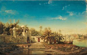
[[Image:Mosque_on_the_banks_of_the_Ganga,_river_India_Auguste_Borget_oil_on_canvas_1846.jpg|thumb|right|300px| | [[Image:Mosque_on_the_banks_of_the_Ganga,_river_India_Auguste_Borget_oil_on_canvas_1846.jpg|thumb|right|300px|Mosque on the banks of the [[Ganges River]] [[India]], Auguste Borget, oil on canvas, 1846]] | ||
Leading Islamic clerics in India have agreed that it is the duty of both Hindus and Muslims to protect and save | Leading Islamic clerics in India have agreed that it is the duty of both Hindus and Muslims to protect and save the Ganges, a national river, as both communities live on its banks and earn livelihood from it.<ref>[http://timesofindia.indiatimes.com/city/lucknow/Muslim-clerics-support-save-Ganga-campaign/articleshow/16216466.cms Muslim clerics support save Ganga campaign]</ref> "Ganga Jamni tehzeeb" is an ancient tradition in the Awadhi doab area for the co-existence of Hindus and Muslims by participating in each others social functions. "Ganga Jamni tehzeeb" fuses the best elements of Persian and Mughal cultures ensuring Khayal, Ghazal, Thumri, Kathak and Banarsi Raas rang flourish. | ||
=====Ganges in Bangladesh===== | =====Ganges in Bangladesh===== | ||
The portions of the eastern sub-delta of the | The portions of the eastern sub-delta of the Ganges is known as "Padma" and had no religious significance or historical places of pilgrimage for Indians unlike in West Bengal along the banks of the Bhagirathi-Hooghly section known a "Adi Ganga". The eastern deltaic portions mainly in Bangladesh were always cut off symbolically from Indo-Aryan culture and mythology.<ref>[http://books.google.co.in/books?id=gKhChF3yAOUC&pg=PA20 Rise of Islam and Bengal Frontier]</ref> | ||
====Ganges in Buddhism==== | |||
From a discourse on "Dharma": | |||
*And again, Subhuti, suppose a woman or a man were to renounce all their belongings as many times as there are grains of sand in the river Ganges; and suppose that someone else, after taking from this discourse on dharma but one stanza of four lines would demonstrate it to others. Then this latter on the strength of that would beget a greater heap of merit, immeasurable and incalculable.<ref>[http://books.google.co.in/books?id=bhRdpEBpKTcC&pg=PA51 Buddha, in Wisdom Beyond Words: The Buddhist Vision of Ultimate Reality (2000), p. 51]</ref> | |||
===References=== | ===References=== | ||
{{reflist}} | {{reflist}}[[Category:Suggestion Bot Tag]] | ||
Latest revision as of 07:01, 20 August 2024
| River Ganges | |
|---|---|
| A major river of India | |
| General | |
| Country | India |
| States | Uttarakhand, Uttar Pradesh, Bihar, Jharkhand, West Bengal, |
| Cities | Haridwar, Kanpur, Allahabad, Varanasi, Kolkata |
| Source | Gangotri Glacier, Uttarakhand, India |
| Mouth | Bay of Bengal |
| Length | 2,525 km |
| Left Tributaries | Mahakhali, Karnali, Kosi, Gandak, Ghaghra |
| Right Tributaries | Yamuna, Son, Mahananda |
| Basin | 896,000 sq.km |
| Discharge | 14,270 cu.m/sec |
| Subpages | |
| Related_Articles, Bibliography | |
The Ganges (India: Ganga; Bangladesh: Padma) is a major river system in the Indian subcontinent which flows west to east through North India's Gangetic plains, traversing 2,525 km in the course to discharge into the Bay of Bengal through its vast delta in the Sunderbans and Bangladesh. Several important tributaries discharge into the Ganges, which is the world's third largest river by discharge volume after the Amazon and Congo rivers. The headstreams of the River Ganges in India's upper course are famous tourist attractions important to local economies, for spiritual tourism and rafting in Rishikesh.
The Ganges river basin is India's largest, irrigating the northern states of Uttarakhand, Uttar Pradesh, Haryana, Rajasthan, Himachal Pradesh, Delhi, Madhya Pradesh, Chhattisgarh, Bihar, Jharkhand, and West Bengal. Important Indian cities on its banks include Kanpur, Patna, Kannauj, Kashi, Allahabad, Varanasi, and Kolkata. These cities generate large amounts of domestic and industrial pollution which has caused the 'holy' Ganges to die. The environmental degradation generated considerable protest and, in 1985, the Indian government implemented a Ganga Action Plan for river rejuvenation.
The Ganges has been sacred to Hindus since ancient times and worshipped as the Goddess Ganga. Hindus make pilgrimages to it, especially to its sources and the cities of Haridwar, Varanasi and Allahabad (the Triveni confluence of the River Yamuna). On its banks are ghats (cremation pyres) and ritual steps for immersing ashes in the water of dead Hindus and performed ritual ablutions.
Geography
The Ganges is traditionally divided into two parts: the upper course (about 800 km from the source to the city of Kanpur), lower course (from Kanpur to the Farakka Barrage).
Upper Course (Himalayas and foothills)
|
Course of the Ganges
Tributaries
Other than the Yamuna, the major water-rich tributaries of the Ganges flow to the left. Originating mostly in the Himalayas, they mitigate the low dissolved oxygen and pollutant concentration of the main stream. However, some of these tributaries also cause the largest flood hazard zone of the Ganges and regular overflowing of its high water banks causing destruction. The natural drainage network is now greatly altered by dense networks of artificial irrigation channels. Consequently, the Ganges and Yamuna have much of their flow diverted into irrigation canals and water treatment plants.
Cities on the Ganges
The valley of the Ganges is one of the most densely populated places on the planet. Below are the largest of the cities located directly on the river. The list is sorted along the course, with the exception of the delta (in the state of West Bengal and Bangladesh). Most of West Bengal and almost a third of the territory of Bangladesh enter directly into the Ganga basin. Specified in the list of the city are located mainly on the distributaries Hooghly and Padma (main channel) as well as numerous small ducts.
- India :
- State of Uttarakhand :
- Rishikesh (59,600) well known for rafting in Rishikesh
- Haridwar (175,100)
- State of Uttar Pradesh :
- Farrukhabad (275,750)
- Kannauj (71530)
- Kanpur (2,767,031)
- Allahabad (1,117,094)
- Mirzapur (233,691)
- Varanasi (1,201,815)
- State of Bihar :
- Ara (203,395)
- Chhapra (178 835)
- Danapur (158488)
- Patna (1,683,200)
- Munger (187,311)
- Bhagalpur (398,138)
- State of Jharkhand :
- nil
- State of West Bengal :
- Baharampur (160,168)
- Krishnanagar (139,070)
- Barasat (237,783)
- Barrackpore (144,331)
- Kolkata (4,486,679)
- Howrah (1,072,161)
- Alipore
- Haldia (170,256)
- Rajshahi (472,775)
- Khulna (855,650)
- Barisal (210,374)
- Jessore (243,987)
- Pabna (138,000)
- Chandpur (94,821)
Sequence of tributary confluence
Alaknanda joins Dhauliganga (at Vishnuprayag), Mandakini (at Nandprayag), Pindar (at Karnaprayag), Mandakini (at Rudraprayag) and ultimately Bhagirathi (at Devaprayag) from where onwards, it is known as Ganges River. The Bhagirathi is considered the prime source stream, fed by melting glacial snow and ice from peaks such as Kamet and Nanda Devi.
| Name |
Mouth of |
Discharge (MQ) [m³/s] |
Length [km] |
Catchment- area [km²] |
Swell [m.] |
Estuary- height [m.] |
Confluence- place |
|---|---|---|---|---|---|---|---|
| Headstreams[1][2] | |||||||
| Alaknanda | left | 440 | 240 | 12587+ | 4350 | 460 | Devprayag |
| Bhagirathi | right | 260 | 254[3] | 7820 | 4120 | 460 | Devprayag |
| Tributaries[4] | |||||||
| Ramganga | left | 490 | 596 | 32493 | 3110 | 130 | Ibrahimpur |
| Yamuna | right | 2940 | 1376 | 366223 | 6387 | 74 | Sahon |
| Ghaghara | left | 2980 | 1080 | 127950 | 4800 | 48 | Chapra |
| Son | right | 900 | 784 | 71259 | 600 | 46 | Dinapur |
| Gandak | left | 1640 | 630 | 46300 | 7620 | 44 | Sonepur |
| Kosi | left | 2160 | 835 | 95156 | 7000 | 34 | Kursela |
Ganges in Indian religion
Ganges in Hinduism
The River Ganges is generally regarded, since ancient times, amongst the world's most important and holiest rivers. It is held sacred by Indians, especially Hindus, and is also worshipped in its anthropomorphic form as the Goddess Ganga, emerging, from Bhagirathi her source, at Gangotri Glacier (in the Central Himalayan state of Uttarakhand) at Gaumukh (elevation 3,892 m). Ganga is embodied at Devprayag when the rampant Alaknanda joins swirling Bhagirathi. Numerous other streams join Himalayan Ganga, among these Mandakini, Dhauliganga, Bhilangana and Pindar are significant.
Ganges in the Doab
According to legend, Allahabad Triveni (triple confluence) is one of the four places where the celestial bird Garuda spilled the immortality elixir Amrita from its holy pitcher, and why Hindus hold major Hindu festival - Kumbh Mela, or "Festival of pitchers."
Allahabad (Prayag also - "the confluence" or Aggra - "place of sacrifice"), located at the confluence of the Ganges with the Jumna (Yamuna), is considered the place where Brahma was brought first sacrifice after creating the world. This is the second of the four places where Garuda spilled amrita, and is also the venue for the festival of Kumbh Mela. This is where the legend comes to the surface and joins the sacred river Ganges Rig Veda - Saraswati, which later disappears from the surface of the Earth.
Ganges in West Bengal
The sanctity of the Ganges in Bengal predates the arrival of Indo-Aryans. After their arrival and association of Ganga river with Aryan purity, important places of pilgrimage came up at Nawadeep, Triveni, Katwa, Ganga Sagar and Kalighat (near Kolkatta).
Ganges in Islam
Leading Islamic clerics in India have agreed that it is the duty of both Hindus and Muslims to protect and save the Ganges, a national river, as both communities live on its banks and earn livelihood from it.[5] "Ganga Jamni tehzeeb" is an ancient tradition in the Awadhi doab area for the co-existence of Hindus and Muslims by participating in each others social functions. "Ganga Jamni tehzeeb" fuses the best elements of Persian and Mughal cultures ensuring Khayal, Ghazal, Thumri, Kathak and Banarsi Raas rang flourish.
Ganges in Bangladesh
The portions of the eastern sub-delta of the Ganges is known as "Padma" and had no religious significance or historical places of pilgrimage for Indians unlike in West Bengal along the banks of the Bhagirathi-Hooghly section known a "Adi Ganga". The eastern deltaic portions mainly in Bangladesh were always cut off symbolically from Indo-Aryan culture and mythology.[6]
Ganges in Buddhism
From a discourse on "Dharma":
- And again, Subhuti, suppose a woman or a man were to renounce all their belongings as many times as there are grains of sand in the river Ganges; and suppose that someone else, after taking from this discourse on dharma but one stanza of four lines would demonstrate it to others. Then this latter on the strength of that would beget a greater heap of merit, immeasurable and incalculable.[7]
References
- ↑ Singh, Hasnain: Major ion chemistry and weathering control in a high altitude basin: Alaknanda River, Garhwal Himalaya, India (PDF; 1,3 MB), 1998
- ↑ Arun Kumar: Assessment of Cumulative Impact of Hydropower Projects in Alaknanda and Bhagirathi Basins (PDF; 5,6 MB), Chapter 7 Hydrology 30. Mar 2011
- ↑ Tributaries
- ↑ Sharad K. Jain, Pushpendra K. Agarwal, Vijay P. Singh: Hydrology and water resources of India. New York 2007
- ↑ Muslim clerics support save Ganga campaign
- ↑ Rise of Islam and Bengal Frontier
- ↑ Buddha, in Wisdom Beyond Words: The Buddhist Vision of Ultimate Reality (2000), p. 51
