Template:Infobox road: Difference between revisions
Jump to navigation
Jump to search
imported>Drew R. Smith No edit summary |
imported>Drew R. Smith m (oops. forgot to take something quite important out...) |
||
| (5 intermediate revisions by the same user not shown) | |||
| Line 10: | Line 10: | ||
| 2_label = Location | | 2_label = Location | ||
| 2_data = {{{country|}}} | | 2_data = {{{country|}}} | ||
{{{city|}}}{{# | {{{city|}}}{{#if:{{{city|}}}|, }}{{{state|}}}{{{province|}}} | ||
| 3_label = Established | | 3_label = Established | ||
| Line 16: | Line 16: | ||
| 4_label = Length | | 4_label = Length | ||
| 4_data = {{convert|{{ | | 4_data = {{convert|{{{length_mi|}}}|mi|km}} | ||
| 5_label = Direction | | 5_label = Direction | ||
Latest revision as of 04:34, 22 July 2009
This template is to be used on articles concerning roads, streets, highways, freeways, or any other notable path.
Parameters
- marker_image-This parameter is used to display the marker attributed to the subject road.
- Road_name-This is the official name of the road
- alternate_name-This is the commonly used name of the road
- country-This is the country the road is located in.
- province-This is the province the road is located in.
- state-This is the state that the road is located in.
- city-This is the city that the road is located in.
- length_mi-This is the length of the road in miles. It will display as a {{convert}}ed figure, including both miles and kilometres
- established-This is the date the road was established. Precise dates are best, but approximations are ok as well.
- direction_a-This is the direction the road is traveling.
- direction_b-This is the alternate direction of the road. Usually the opposite of direction_a.
- starting_terminus-This is where the road officially begins.
- ending_terminus-This is where the road officially ends.
- junction-This is a list of major junctions.
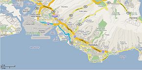
- map-This displays a map of the road and its surroundings.
Examples
| Hawaii route 92 | |
|---|---|
| Nimitz Highway | |
| Location | United States of America
Honolulu, Hawaii |
| Established | 1940's |
| Length | 9.3 mi (14.97 km) |
| Direction | East-West |
| East end | 0.6 miles east of the Ala Wai Canal in Waikiki |
| West end | |

| |
{{Infobox road
|marker_image=Nimitzhighway.jpg
|Road_name=Hawaii route 92
|alternate_name=Nimitz Highway
|country=United States of America
|state=Hawaii
|city=Honolulu
|length_mi=9.3
|established=1940's
|direction_a=East
|starting_terminus=0.6 miles east of the Ala Wai Canal in [[Waikiki]]
|junction=
|direction_b=West
|ending_terminus=[[Image:I-H1.jpg|20px]] [[Interstate H-1]] in [[Honolulu, Hawaii|Honolulu]]
|map=Nimitz highway.jpg
}}