File:Onslow County, North Carolina.png: Difference between revisions
Jump to navigation
Jump to search

imported>Caesar Schinas m (Bot: Remove blank Template:(C)) |
imported>Caesar Schinas m (Bot: Replace Template:Image_notes_* with Template:Image_Details) |
||
| Line 1: | Line 1: | ||
== Summary == | == Summary == | ||
{{ | {{Image_Details | ||
|description = Map showing Onslow County, North Carolina. | |||
| | |author = [[User:Stephen Ewen|Stephen Ewen]] | ||
| | |copyright = [[User:Stephen Ewen|Stephen Ewen]] | ||
| | |source = Map of Onslow County: [http://www2.census.gov/geo/maps/general_ref/cousub_outline/cen2k_pgsz/nc_cosub.pdf United States Census Bureau][http://www2.census.gov/geo/maps/general_ref/cousub_outline/cen2k_pgsz/nc_cosub.pdf]; map of North Carolina: [http://commons.wikimedia.org/wiki/User:Dbenbenn David Benbennick][http://en.wikipedia.org/wiki/Image:Map_of_North_Carolina_highlighting_Onslow_County.svg]; | ||
| | |date-created = 3 October 2007 | ||
| | |pub-country = United States | ||
| | |notes = When using this image outside of Citizendium, credit to citizendium.org. When using within Citizendium, credit to Stephen Ewen. | ||
| | |versions = [[Image:Onslow_Beach.png|75px]] [[Image:Onslow.jpg|75px]] | ||
| | |||
}} | }} | ||
== Licensing/Copyright status == | == Licensing/Copyright status == | ||
{{Attribution}} | {{Attribution}} | ||
Revision as of 03:50, 22 June 2009
Summary
| Title / Description
|
Map showing Onslow County, North Carolina. |
|---|---|
| Author(s)
|
Stephen Ewen |
| Copyright holder
|
Stephen Ewen See below for license/re-use information. |
| Source
|
Map of Onslow County: United States Census Bureau[1]; map of North Carolina: David Benbennick[2]; |
| Date created
|
3 October 2007 |
| Country of first publication
|
United States |
| Notes
|
When using this image outside of Citizendium, credit to citizendium.org. When using within Citizendium, credit to Stephen Ewen. |
| Other versions
|
 
|
| Using this image on CZ
|
Copy the code below to add this image to a Citizendium article, changing the size, alignment, and caption as necessary.
|
![[2]](https://en.wikipedia.org/wiki/Image:Map_of_North_Carolina_highlighting_Onslow_County.svg)
Image issue? Contact us via the email below.
Please send email to manager A T citizendium.org .
Licensing/Copyright status
This media, Onslow County, North Carolina.png, is copyrighted but may be reused
The copyright holder has stipulated that anyone may freely copy, distribute, display and perform this work, as well as make derivative and commercial works, provided that you attribute the work in the manner specified by the author or licensor (but not in any way that suggests that they endorse you or your use of the work). This applies in perpetuity.
File history
Click on a date/time to view the file as it appeared at that time.
| Date/Time | Thumbnail | Dimensions | User | Comment | |
|---|---|---|---|---|---|
| current | 19:54, 11 March 2022 | 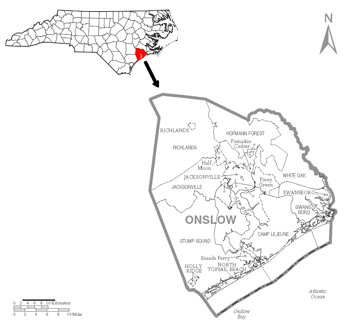 | 1,217 × 1,140 (110 KB) | Maintenance script (talk | contribs) | == Summary == Importing file |
You cannot overwrite this file.
File usage
The following page uses this file: