Queen Street (Toronto)
Jump to navigation
Jump to search

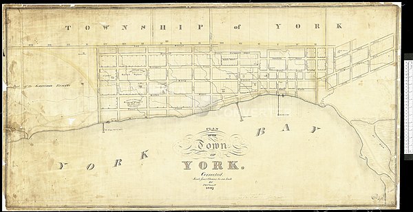
Queen Street, called Lot Street on this map, was the northernmost street in York, Upper Canada.
Queen Street is an important east-west street in Toronto Canada. It was the northernmost street on the town-site laid out for York, Upper Canada, when Lieutenant Governor John Graves Simcoe chose it as Upper Canada's permanent capital.
Queen Street was the first Concession Line in Governor Simcoe's first land survey. And he divided the land between Queen, and the next Concession Line - now Bloor Street - into narrow lots, of 100 acres, that he granted to individuals he appointed as the new Provinces officials. This lead to Queen Street having an alternate name, Lot Street.
By the early 20th century North America's longest streetcar route, the 501 Queen, ran along Queen Street.